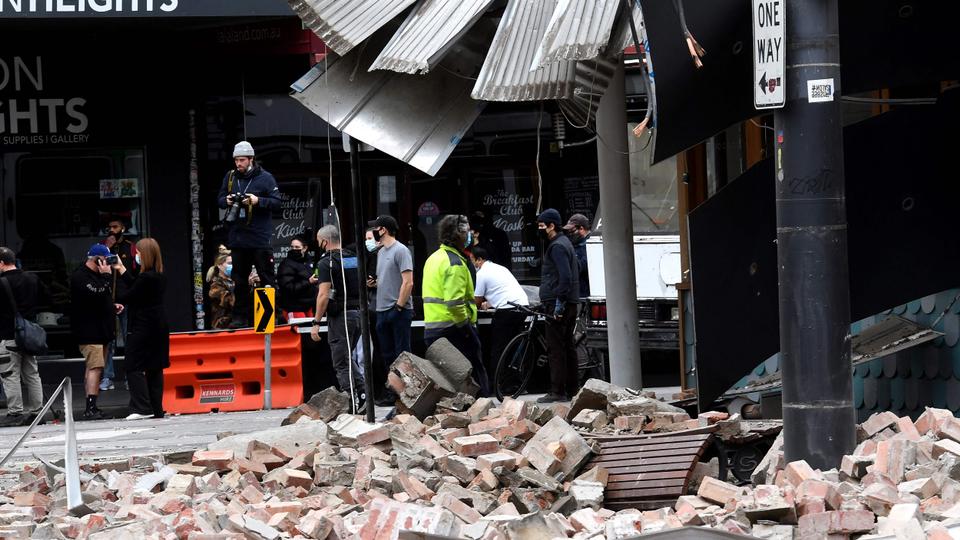
The natural disaster damaged buildings in the country’s second largest city, Melbourne, with no reports of serious injuries. A magnitude 6.0 earthquake struck near Melbourne, Geoscience Australia has said, one of the country’s biggest quakes on record, causing damage to buildings in the country’s second largest city and sending tremors throughout neighbouring states.
The quake’s epicentre was near the rural town of Mansfield in the state of Victoria, about 200 km (124 miles) northeast of Melbourne, and was at a depth of 10 km (six miles). An aftershock was rated 4.0.
Images and video footage circulating on social media showed rubble blocking one of Melbourne’s main streets, while people in northern parts of the city said on social media they had lost power and others said they were evacuated from buildings.
The quake was felt as far away as the city of Adelaide, 800 km (500 miles) to the west in the state of South Australia, and Sydney, 900 km (600 miles) to the north in New South Wales state, although there were no reports of damage outside Melbourne and no reports of injuries.
More than half of Australia’s 25 million population lives in the southeast of the country from Adelaide to Melbourne to Sydney.
“We have had no reports of serious injuries, or worse, and that is very good news and we hope that good news will continue,” Prime Minister Scott Morrison told reporters in Washington.
“It can be a very disturbing event, an earthquake of this nature. They are very rare events in Australia and as a result, I am sure people would have been quite distressed and disturbed.”
Quakes are relatively unusual in Australia’s populated east due to its position in the middle of the Indo-Australian Tectonic Plate, according to Geoscience Australia. The quake on Wednesday measured higher than the country’s deadliest tremor, a 5.6 in Newcastle in 1989, which resulted in 13 deaths.


Comment here